So much about driving is a form of isolation.
When will that traffic light turn green?
Are there any school zones, pedestrians, or cyclists nearby?
Is that fire truck approaching this intersection?
But that’s not the case along a six-mile stretch of Cooper Street in Arlington, Texas.
Cooper Street Smart Mobility Corridor keeps drivers informed
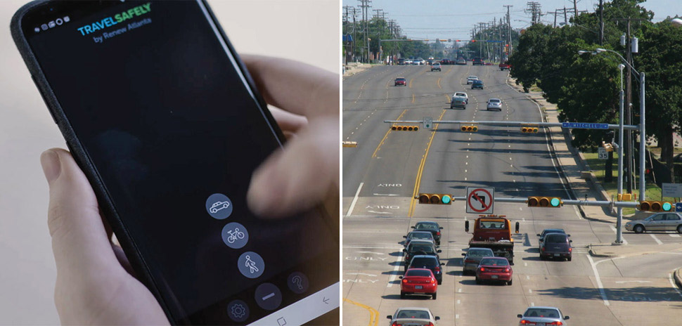
For the past 18 months, people using the Glance TravelSafely phone app have cut through that isolation. The app informs users of varying traffic conditions including traffic light changes, nearby pedestrians and cyclists, and approaching rescue vehicles. The app—and the cell devices installed by the City of Arlington— are referred to as “connected vehicle-to-everything” technologies. The city calls the project its Cooper Street Smart Mobility Corridor.
Fire trucks can make a light turn green for safe passage
The project allows paramedics and firefighters to alter traffic signals, so their rescue vehicles can pass unhindered through intersections. Ten City of Arlington fire trucks have been equipped with devices capable of changing traffic signals.
More importantly, if the project is successful and has enough funding, it could be scaled out across the city of Arlington. One day, these connected-vehicle technologies—which have a range of about 900 feet—might become ubiquitous.
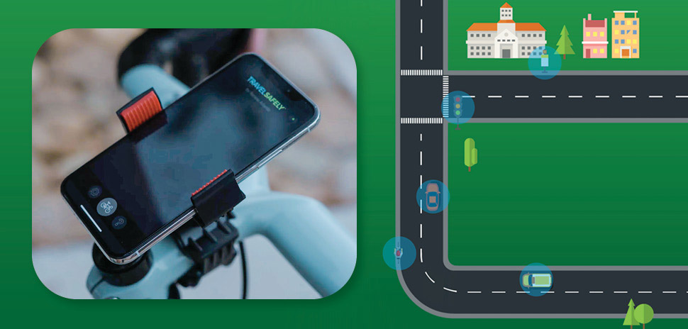
Bicyclists can use the TravelSafely app too. [Video still and illustration: TravelSafely – https://youtu.be/4MnmOFxOIUE]
Connecting drivers to their surroundings
Cooper Street at rush hour is beet-red on a traffic heatmap. Nearly 100,000 vehicles crowd sections of the street per day, earning it the attention (and ire) of both city leaders and residents.
So much so that the city allocated $300,000 from its general fund to attack the problem with its smart-city solution, which earned Arlington an international award (one of nine U.S. cities honored in 2020). The stretch of Cooper Street includes 31 traffic signals between Lamar Boulevard and the frontage road on the south side of Interstate Highway 20.
School zone flashers get connected vehicle tech
School zone flashers in the Cooper Street project are being fitted with connected vehicle technology, to remind drivers to slow their rolls at applicable times.
The Cooper Street project also builds upon the data-collection capabilities of the city’s Traffic Management Center to improve traffic-light timing.
Drivers who use the TravelSafely app—which was developed and is supported by Applied Information—will experience the most immediate impact. Applied Information President Bryan Mulligan has indicated if the app has widespread use, it can reduce delays at traffic signals by 5 to 10%.
Applied Information—which has offices in Georgia, California, Texas, South Africa, and India—has been working with cities across the U.S. to expand the adoption of its technologies. Several hundred cities have adopted the TravelSafely technology, according to Applied Information spokesman Bill Wells. Locally, both Arlington and Frisco are working with Applied Information.
“We chose the path of proven technology,” City of Arlington Public Works Senior Engineer Paul Iwuchukwu wrote in response to a Dallas Innovates query asking how Arlington settled on TravelSafely. “We have tested the app for over two years.”
The Cooper Street plan—developed with help from AECOM—is part of the City of Arlington’s master plan to create a more connected, livable city, called “99 Square Miles.”
‘Green wave’ reaches Main Street
Since 2017, only Audi drivers have experienced connected vehicle-to-everything technology in a handful of cities in the Dallas region. Between 2017 and today, the cities of Frisco, Flower Mound, and Plano have installed that tech at intersections.
Through that program, drivers operating newer Audis with connected-vehicle tech receive messages from their dashboards, including suggestions for the speed they should be traveling at to avoid stop lights, street speed limits, and how long until a red light will turn green. An expanded version of that initiative was launched in 13 metros across the U.S. in 2019, when Audi invited drivers to catch the “green wave” in avoiding red-light stops. The technology works with certain models of 2017-and-newer Audis.
Audi executed this with Sugar Land-based traffic control device contractor Trafficware and auto industry data provider Traffic Technology Services. Frisco became the first city in Texas to do so in 2017.
Allen and Grapevine are in the process of adopting the system as well.
Frisco, meanwhile, has also installed Applied Information devices in some of its signage as well, and is still working out technical details in its implementation.
Whether drivers are using the Glance TravelSafely app in Arlington or the Audi-supported connected-vehicle tech, they’re still going to have to rely upon an app like Google Maps or Waze if they use online navigation assistance.
![]()
Get on the list.
Dallas Innovates, every day.
Sign up to keep your eye on what’s new and next in Dallas-Fort Worth, every day.
R E A D N E X T
-
The NTXIA is a founding member of the new National Smart Coalitions Partnership, now one of the largest smart cities networks in the country. The organization unites more than 100 governments across seven regional smart cities consortiums. The goal? To accelerate sustainability and resilience in communities.
-
Five local winners received up to $200,000 in funding to activate their solutions throughout North Texas.
-

Kessler helped Topgolf triple in size to nearly $1 billion in revenue, growing its venues from 25 to 70. Now he's bringing his track record of experiential innovation and franchise-building to the world of plant-based personal care.
-
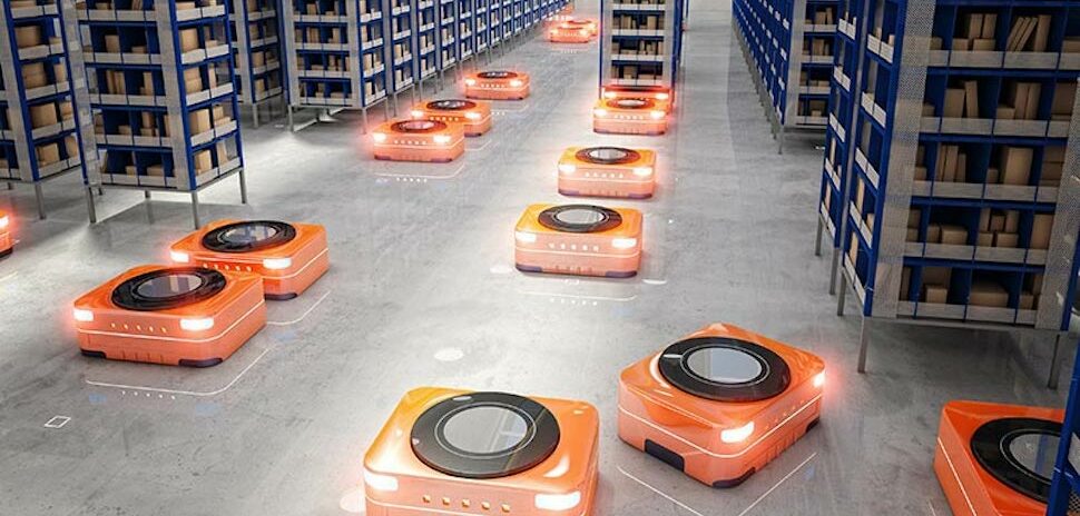
TI says its Hall-effect sensor is "the industry's most accurate." The 3D-sensing technology is a boon for smart factories and the real-time control of devices like autonomous robots.
-

The app turns your smartphone into a "virtual fitting room" with machine learning and AR tech.