 A neighborhood in South Dallas will be the first in Dallas to undergo a makeover that will make it more pedestrian friendly, while incorporating tech that allows people and vehicles to flow more smoothly.
The question is: how extensive will its tech/mass transit components be?
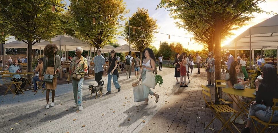
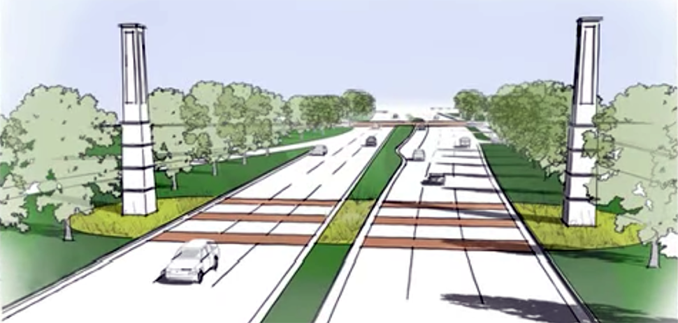
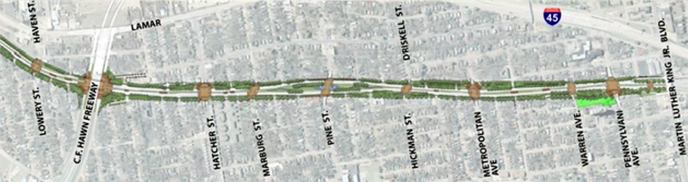
City of Dallas Transportation Director Michael Rogers envisions a 1.5 mile stretch of the S.M. Wright Highway in Southern Dallas as a pedestrian- and bike-friendly meeting place, where buses scoot through traffic with little impediment. Surrounding and underlying this would be sensors and software that give pedestrians, buses, and bicyclists priority.
To realize that vision, the city of Dallas has combined with other agencies in hopes of pulling in millions in federal grants to cover those costs — especially as they relate to creating dedicated bus lanes. The city is working with the Texas Department of Transportation, the North Central Texas Council of Governments and Dallas Area Rapid Transit to submit a joint application for millions of federal dollars.
The grants — issued through the Advanced Transportation and Congestion Management Technologies Deployment initiative — are awarded competitively through the USDOT’s Highway Trust Fund.
“Both DART and the city lost last year,” Rogers said. “Now, we’re teaming up and we’ve got a really strong project.”
Rogers said the grant applications are due in June, and will be announced in August.
Among the features he would like to incorporate:
- A dedicated bus lane in either direction that would allow express transit through intersections;
- Bus stops with public Wi-Fi access and countdown timers; and
- LED street lights that could be loaded with sensors that could provide further Wi-Fi coverage, detect public disturbances, and even pollution levels;
Even without the large infusion of additional federal highway money for smart-city technology, S.M. Wright is in for a major facelift.
A 1.5-mile stretch of S.M. Wright Freeway already was slated to be converted from a high-speed highway to a low-speed boulevard with wide sidewalks and space for bike lanes.
Introducing smart-city features, such as sensors and traffic-control boxes will allow the city’s $8.9 million computer system to synchronize traffic flow.
The city of Dallas has moved to take the project a step further, with an initiative of introducing smart-city features, such as sensors and traffic-control boxes will allow the city’s $8.9 million computer system to synchronize traffic flow.
Without additional grant funding, however, Rogers said, the city would have to seek alternate funding to pay for the more elaborate smart-city features.
Rogers said the Wright project already was accomplishing many of the city’s goals in reconnecting neighborhoods and making them more hospitable for pedestrians, cyclists and businesses. Such improvements match what the city of Dallas is attempting to incorporate into roads, in its “complete streets” initiative.
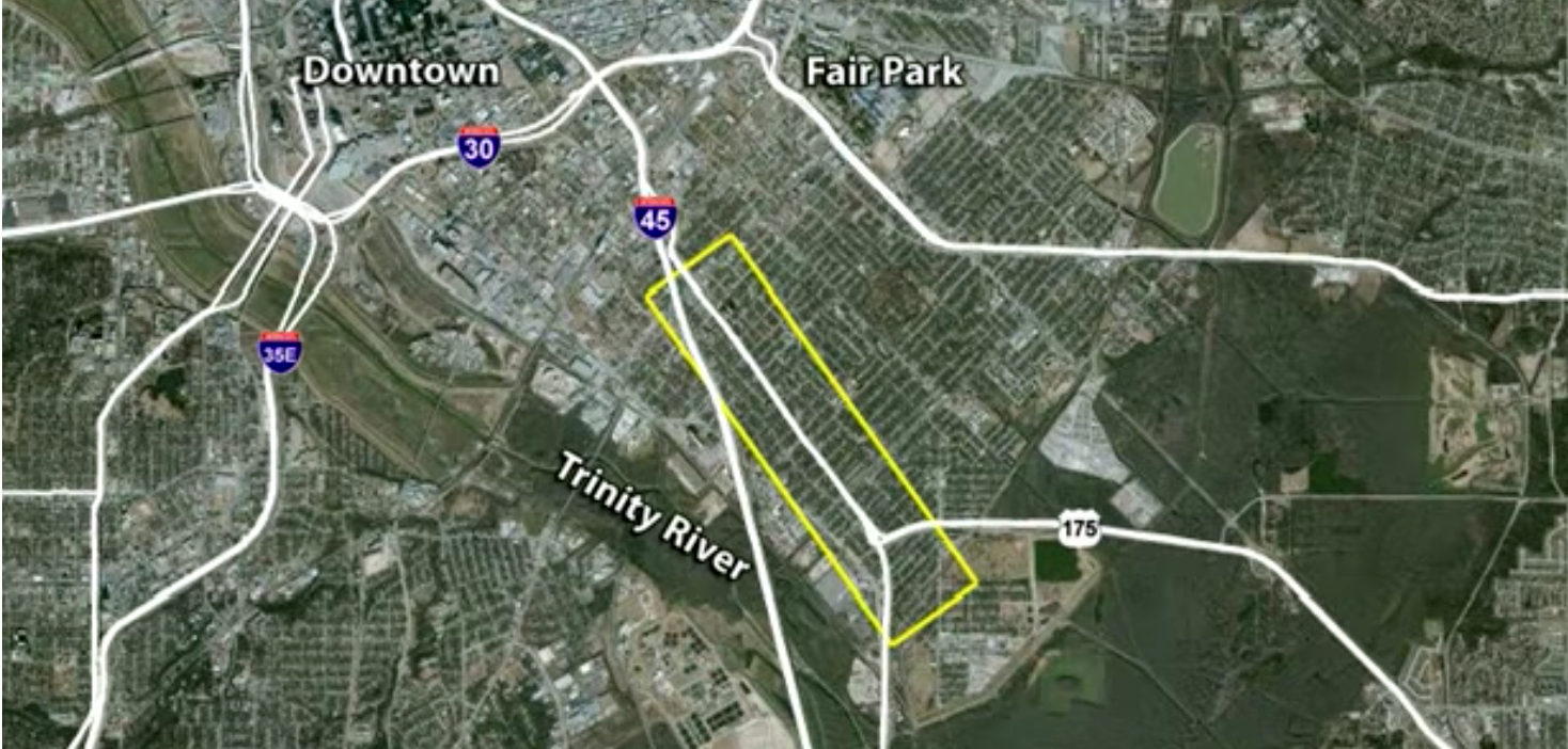
Like many highway projects after World War II, the S.M. Wright Freeway was built in Southern Dallas in the 1950s, cutting predominately minority communities in half.
The new project “will reknit an African American neighborhood that was divided when US 175 was constructed in the 1950s,” states a federal grant application for the $166 million project.
The new project “will reknit an African American neighborhood that was divided when US 175 was constructed in the 1950s,” states a federal grant application for the $166 million project.
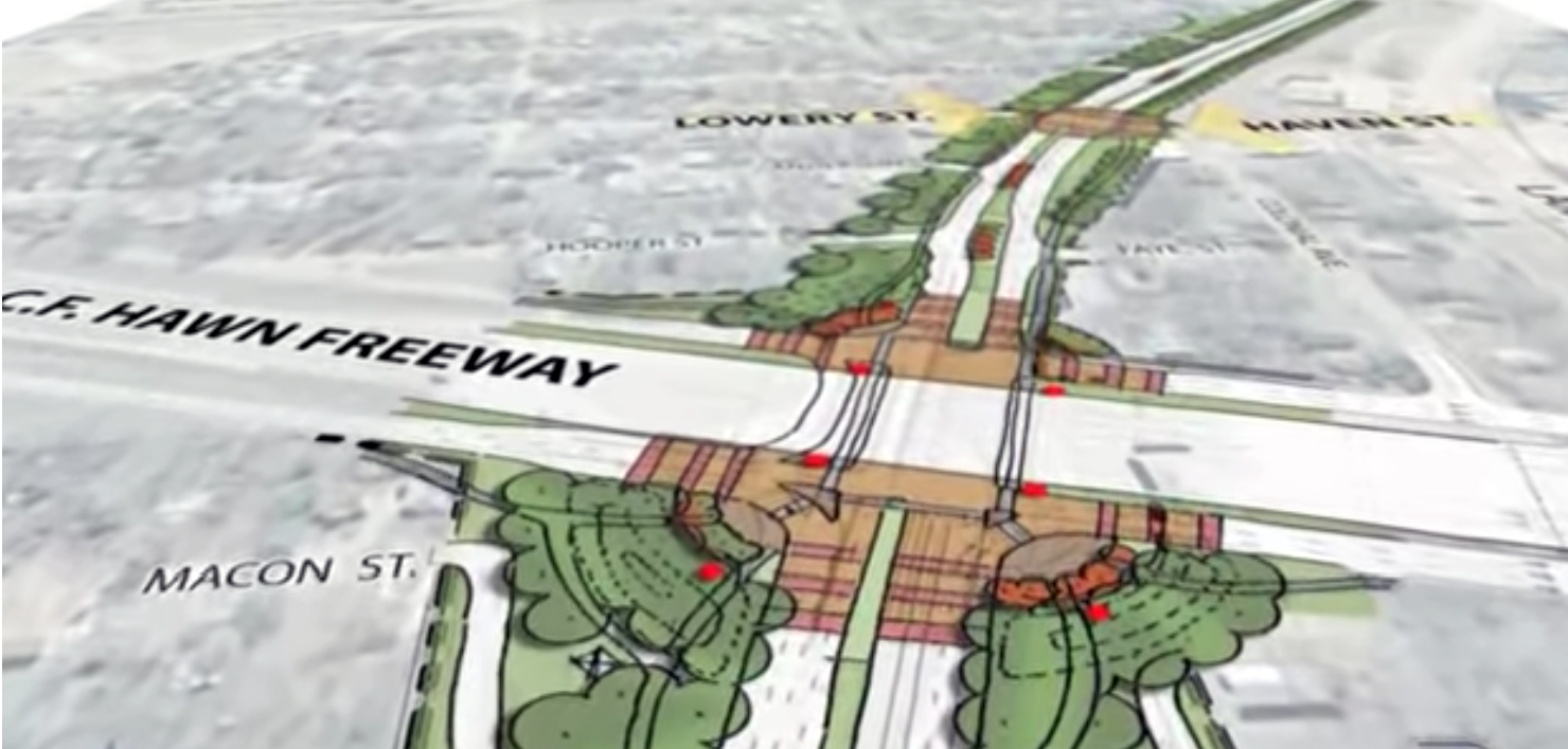
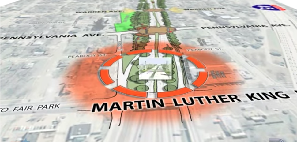
The first phase of the Wright project aims to eliminate a dangerous jag in the highway, and to divert heavier, express traffic to U.S. 30. The second phase – slated to begin in 2019 and to be completed in 2022 – will result in:
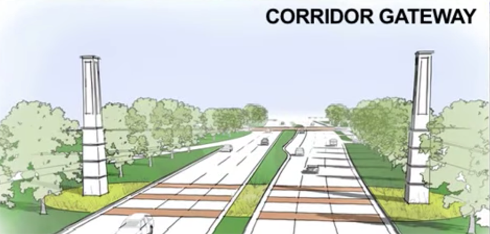
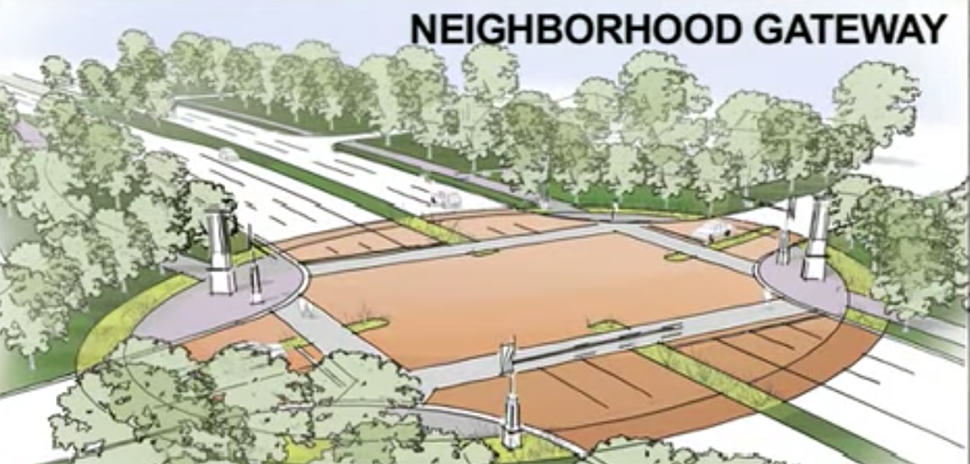
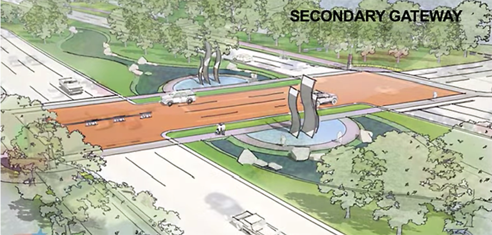
- flattening the S.M. Wright and all overpasses, and installing crosswalks at major intersections, clearing vistas for residents, pedestrians and drivers;
- installing grassy boulevards, occasional water features, and even gateways signifying some neighborhoods and even possible water features; and
- integrating a variety of smart city features, which have yet to be determined.
“TxDOT had a meeting with the city, NCTCOG [the North Central Texas Council of Governments] and DART [Dallas Area Rapid Transit] on May 9, 2018, to discuss the project,” TxDOT Spokesman Tony Hartzel wrote in response to a query from Dallas Innovates. “The city will provide TxDOT a wish list of smart elements they want considered.”
The conversion of Wright into a city street will effectively place it in the city’s jurisdiction.
S.M. Wright will serve as one of two complete streets/smart city test beds for the city of Dallas, which is developing templates for how its roads and intersections should be built and rebuilt in the future.
In the process of rehabbing roads, the city will attempt to install data-driven elements as well, such as traffic-control boxes that sync traffic lights to traffic flow, high-efficiency light-emitting diode streetlights that also will be loaded with sensors. When the city’s putting in new roads, it’s an ideal time to embed such things as power strips for charging electric vehicles, as well, Rogers has said.
GALLERY
WATCH
S.M. Wright Project: Aesthetic Master Plan
![]()
Get on the list.
Dallas Innovates, every day.
Sign up to keep your eye on what’s new and next in Dallas-Fort Worth, every day.
R E A D N E X T
-
The hybrid event in August will take place in person at SMU and virtually. The seventh annual Dallas Startup Week powered by Capital One is Dallas-Fort Worth's largest event focused on driving entrepreneurial success, economic impact, and innovation in the region.
-

You'll find deadlines coming up for a new accelerator program; and many more opportunities.
-
The NTXIA is a founding member of the new National Smart Coalitions Partnership, now one of the largest smart cities networks in the country. The organization unites more than 100 governments across seven regional smart cities consortiums. The goal? To accelerate sustainability and resilience in communities.
-
Five local winners received up to $200,000 in funding to activate their solutions throughout North Texas.