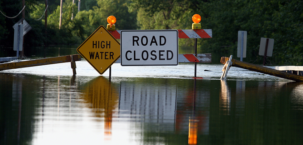
After catastrophic flooding last year claimed more than 130 lives in Central Texas, The University of Texas at Arlington and Rice University have received a $4 million grant from the Office of Governor Greg Abbott to create a real-time flood warning system designed to help prevent future loss of life.
“The number one priority of our state is the safety of our fellow Texans,” Abbott said in a statement. “This grant will provide critical funding to enhance emergency alert systems. I thank UT-Arlington for working to implement improved weather monitoring systems to provide Texans with accurate emergency warnings. Together, we’ll work to protect Texans and deliver a safer future for all.”
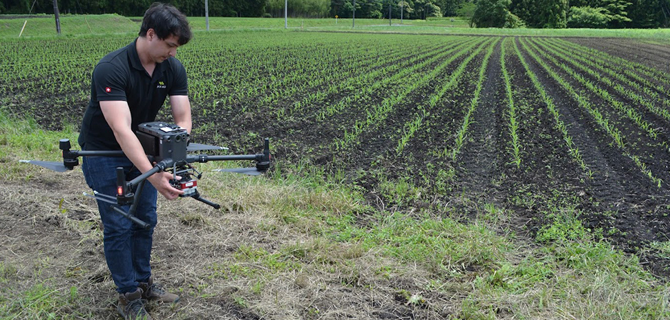
UTA’s Water Engineering Research Center (WERC) will provide a high-resolution, Texas-focused weather monitoring and modeling network to deliver faster, more precise flood warnings in flood-prone areas of the Texas Hill Country. The system is designed to give residents and emergency managers more time to respond as conditions change quickly.
“This investment allows us to move from research to real-time action,” Nick Fang, the Robert S. Gooch Endowed Professor and director of WERC, said in a statement. “By combining advanced forecasting, high-resolution weather monitoring, and proven flood modeling techniques, we can provide communities with faster, more accurate warnings that help protect lives and property.”
Partnering with the SSPEED Center
To help deploy the warning system, Fang will partner with the Severe Storm Prediction, Education and Evacuation from Disasters (SSPEED) Center at Rice University, where he is a founding researcher. The collaboration with the SSPEED Center, led by Director Philip Bedient, leverages expertise in storm prediction, flood modeling, and emergency response planning, UTA said.
“Texas faces some of the most complex and fast-moving flood risks in the nation,” Fang said. “By combining local monitoring with advanced modeling, we can reduce uncertainty and deliver actionable information to decision-makers when every minute counts.”
WERC and Rice University’s SSPEED Center have developed storm surge and flood modeling in Houston and along the Gulf Coast for decades. Together, they will create the computer modeling system and comprehensive floodplain map library that serve as the foundation of the operational warning platform, UTA said.
‘Early warning doesn’t start with a siren—it starts with science’
While flood warnings often come from sirens or text alerts, the new system begins much earlier—using radar-derived rainfall data fed into advanced hydrologic and hydraulic models to forecast flood water depths at specific locations, UTA said. The system provides actionable predictions to emergency officials before waters reach critical levels.
The approach builds on more than 20 years of experience protecting high-risk areas such as Houston’s Texas Medical Center, where SSPEED’s radar-based Flood Information and Response System (FIRST) provides real-time flood mapping for hospitals and other essential facilities.
Fang developed the floodplain map library concept at Rice University along with the first flood warning system for the Texas Medical Center. UTA said that WERC will oversee the development of the new early warning system for the Hill Country that works with radar data and stream gauge information to provide a real-time framework supported by SSPEED, improving accuracy during fast-moving storm events.
“Early warning doesn’t start with a siren—it starts with science,” Bedient said. “By combining radar rainfall, stream measurements and predictive modeling, we can forecast how deep the water will be and where it will go, giving communities the lead time they need to make life-saving decisions.”
Warnings that are timely, clear, and actionable
The project also aims to strengthen collaboration among state agencies, regional water authorities, and local communities to ensure that the technology translates into coordinated, life-saving emergency response strategies. In addition to deploying equipment, researchers will work with stakeholders to develop communication protocols so warnings are clear, accessible, and easy to act on.
“It’s critical to use precise weather data in flood modeling and warning to provide reliable predictions for emergency operations,” said Dr. Daniel Li, an assistant professor of research at WERC.
“Equally important is how we communicate risk,” said Matt Lepinski, assistant program director for WERC. “Our goal is to ensure every warning is timely, clear and immediately actionable for the communities we serve.”
Making ‘Texas more resilient’
Funded through the governor’s office as part of a broader effort to enhance disaster preparedness, the initiative builds on UTA’s leadership in water engineering research and disaster resilience. WERC has led numerous projects in urban flooding, stormwater infrastructure, and weather adaptation, making the university a key partner in helping Texas communities prepare for and respond to extreme weather, UTA said.
Recently, WERC and Dallas/Fort Worth International Airport expanded a multi-year partnership to improve stormwater management, environmental protection, and long-term operational resilience at one of the world’s busiest airports.
“This is about giving communities the tools they need to stay ahead of the next storm,” Fang said. “With the right science and the right partnerships, we can make Texas more resilient.”
Don’t miss what’s next. Subscribe to Dallas Innovates.
Track Dallas-Fort Worth’s business and innovation landscape with our curated news in your inbox Tuesday-Thursday.
R E A D N E X T
-
Jacobs said Flood IQ provides a unified operational view by combining rainfall radar, river and coastal conditions, stormwater and wastewater network data, and critical infrastructure data. The platform uses AI-powered analytics to forecast both where and when flooding may occur—and supports coordinated actions to protect communities during severe weather events.
-

The interactive exhibit will be on public display at the Fan Festival at Dallas’ Fair Park this summer. Coinciding with the full World Cup tournament, fans can enjoy free live match screenings, food, music, and entertainment. Entry to the Fan Festival and the exhibit is free.
-

Conceived by boutique hotel originator Ian Schrager in partnership with Marriott International, Chalk Hill's Dallas EDITION will offer a 214-key five-star hotel and 60 luxury residences. The luxury brand's first property in Texas will be located on a 2.5-acre site with direct access to the Katy Trail and the Dallas North Tollway. Starting price for a one-bedroom residence: $1.5 million.