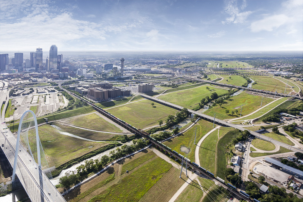
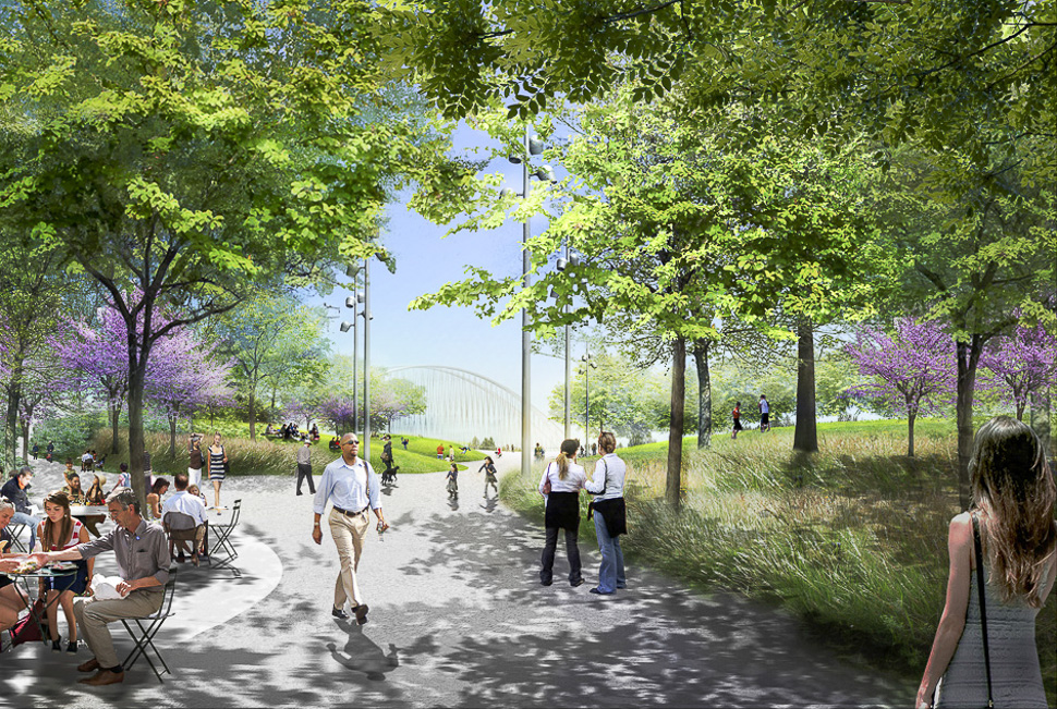
The Trinity River Park concept, unveiled by Mayor Mike Rawlings last May, encompasses more than 285 acres of land near the heart of downtown Dallas. The concept — more than 50 times larger than Klyde Warren Park — envisions a new naturalized river landscape that is ever-changing with miles of pathways and trails within the levees, and includes sites for five elevated parks that will extend from inside the levees into the adjacent communities, according to a release. The concept, which was funded through private donors, also allows for the Trinity Parkway, which will provide primary access into the park and will require separate funding.
View of the Trinity River floodway looking southeast with the Margaret McDermott Bridge and the Trinity Skyline Trail along the Trinity River.
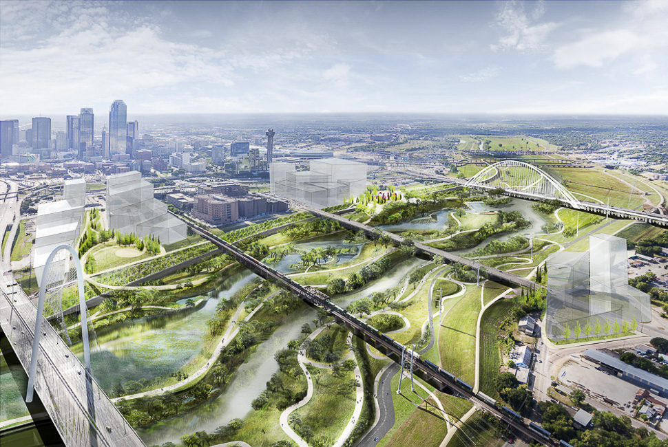
The Trinity River Park concept in the Trinity River floodway looking southeast. Two elevated overlook parks are located on the downtown side at Riverfront Boulevard and Reunion Boulevard. One elevated overlook park is located on the west side at Commerce Street. The river meanders in a more naturalized state with a varying river landscape including trails running throughout the corridor.
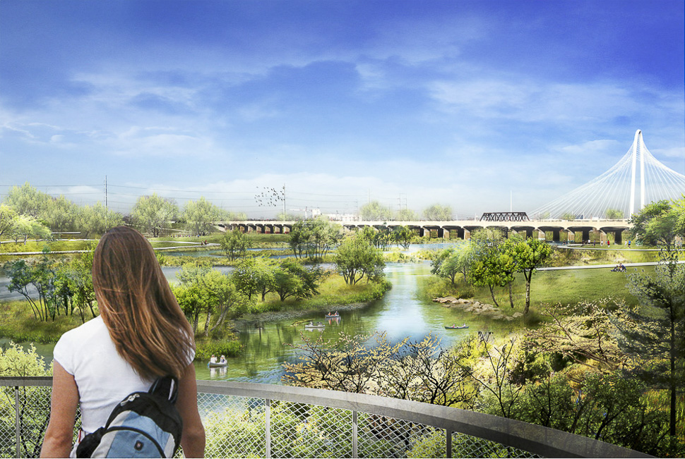
View of the naturalized Trinity River landscape from the Reunion Boulevard overlook.
The Trinity River Park concept in the Trinity River floodway welcoming a two-to-three year flood event.
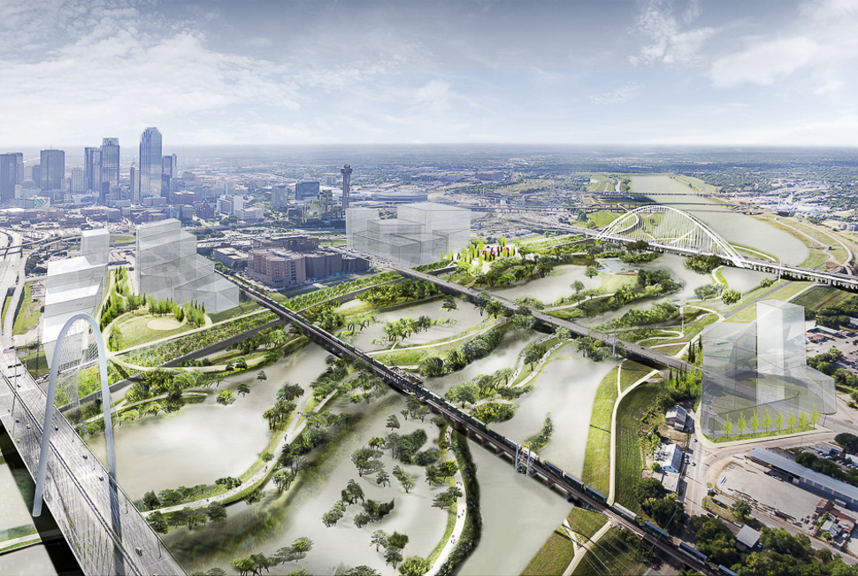
The Trinity River Park concept in the Trinity River floodway welcoming a one-year flood event.
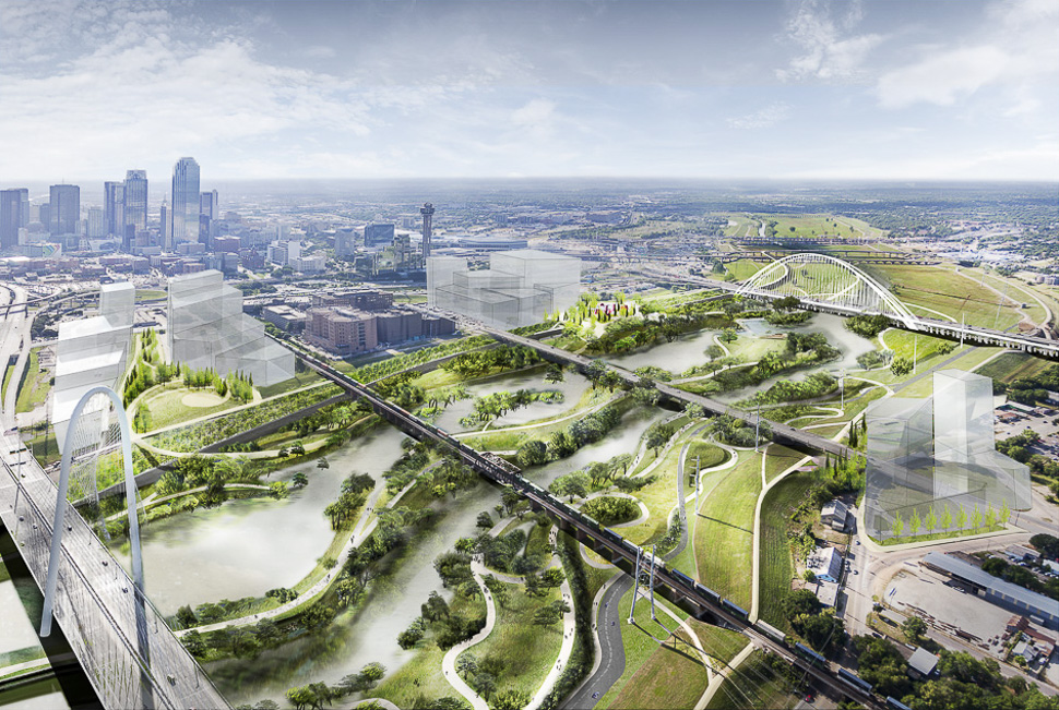
Reunion Boulevard overlook approaching from the southwest looking towards the Margaret McDermott Bridge.
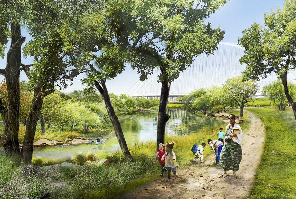
A soft trail running in the naturalized Trinity River corridor. [ Renderings: Michael Van Valkenburgh Associates via The Trinity Trust Foundation ]
WATCH
READ NEXT
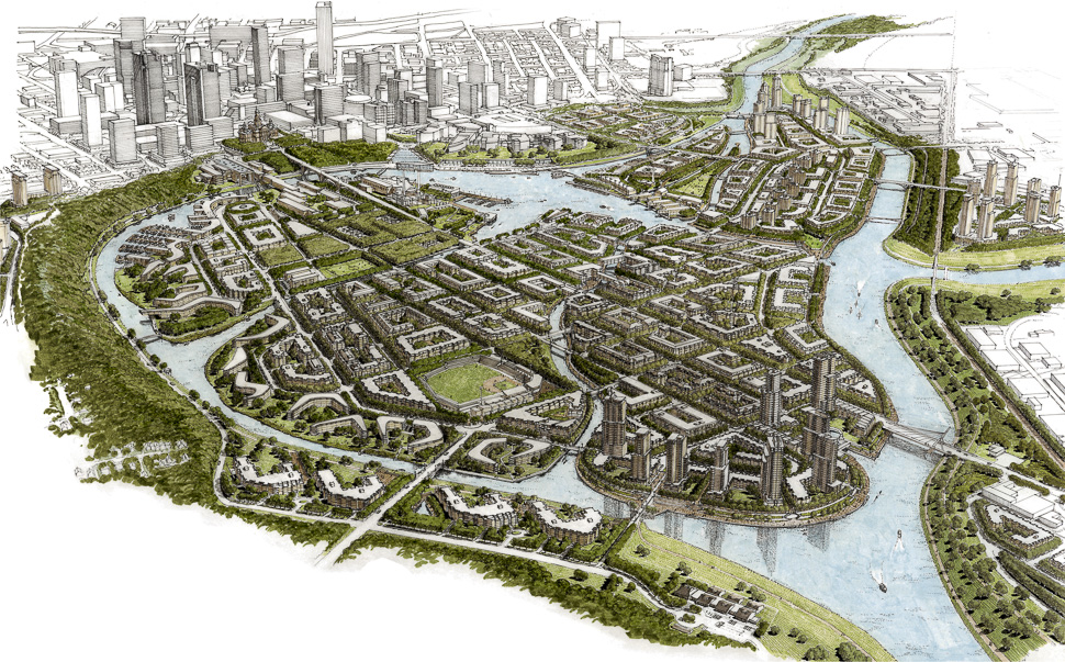
The Panther Island project, also known as Central City, is located in an industrial area north of downtown Fort Worth. The project will create a new urban district on an island combining mixed-use neighborhoods with a network of canals and a lake to control flooding. [Rendering: Courtesy of Trinity River Vision Authority ]
Panther Island Project Lands $526M Federal Boost
The funding recently approved by Congress brings the massive project in Fort Worth closer to reality.
Panther Island Project Map
Trinity River Vision Authority estimates that public improvements related to Panther Island will virtually double the size of downtown and generate more than $600 million in economic development activity during the first decade alone. It’s expected to create 16,000 jobs, over 10,000 housing units and 12 miles of waterfront land for private development. Here’s a map of the plan.
UTA Dean: Trinity River ‘Linear District’ Would be DFW Hub
The river would be the “magnetic core” to all the great institutions and attributes that Dallas-Fort Worth has to offer.
Dallas Innovates, Every Day: Get the e-newsletter here.
R E A D N E X T
-
The U.S. Army Corps of Engineers announced plans Wednesday to spend $403 million on the final design and build of a 1.5-mile flood-control bypass channel, which will reroute part of the Trinity River near downtown Fort Worth—and create Panther Island. Fort Worth hopes the 800-acre island will become a massive housing and mixed-use entertainment and recreational district, connecting downtown Fort Worth to the city’s cultural district and the Stockyards.
-
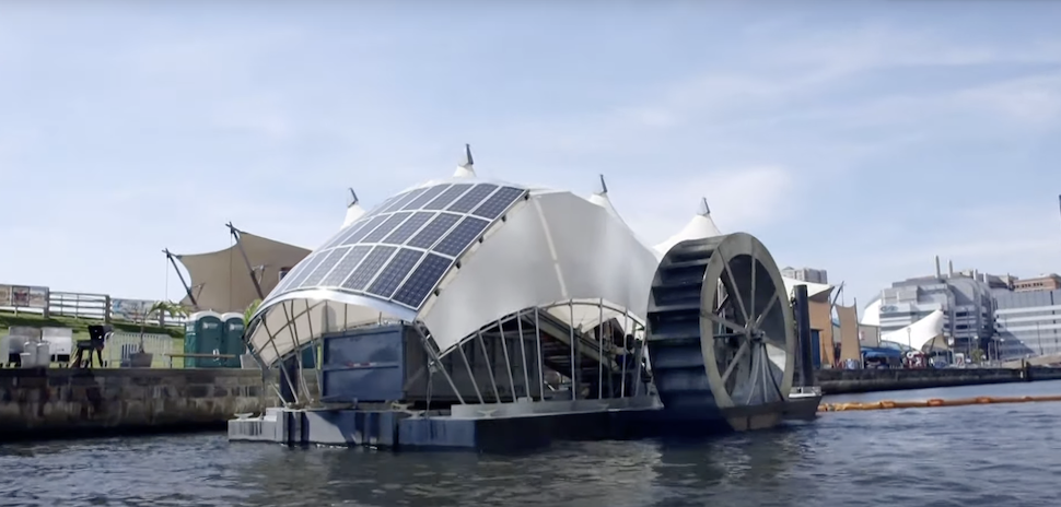
Powered by the sun and the river's current, two Trinity River Waterwheels will be able to capture tons of floating pollution daily—keeping the waterway pristine as it flows through Fort Worth. The city council voted Tuesday to accept private donations to support the initiative. One official says the results will be "astonishing."
-

A group of industry, nonprofit, and governmental organizations—including Texan by Nature, Molson Coors, Coca-Cola, Frito-Lay and PepsiCo, and Keurig Dr Pepper—have formed the Texas Water Action Collaborative to improve the water quantity and quality of the Trinity River.
-

The automaker brands will sponsor the Marcus Graham Project's annual iCR8 Boot Camp for three years starting in 2022—the organization's 15-year anniversary. The bootcamp will provide real-world exposure and experience to diverse marketing and media aspirants, helping them bolster meaningful industry careers.
-

The Water Cooler at Pegasus Park—the largest shared nonprofit space in Texas — is a place designed to accelerate impact, together. From Big Thought to SVP Dallas to The Trust for Public Land, the 15 ‘exceptional nonprofits' were picked after an application process last summer. They’ll join Water Cooler's five founding tenants.