MORE►
Geospatial Science

The Sinai region of Egypt. [Photo Copyright bennymarty via iStock]
UTD Researchers Aid Egypt Control Flooding
by Lance Murray | Nov 10, 2016
Geospatial science methods were used to decision-making about the region in the Sinai Peninsula.
Related Articles
Calendar: Not-to-Miss Events for Innovators in Dallas-Fort Worth
Apply Now:
Opportunities for North Texas Innovators The Last Word: SMU ‘Big Ideas’ Winner Creates Laundromat Libraries for Pint-Sized Readers Perot Museum Debuts ‘Soccer: More Than a Game’ Exhibition in Runup to World Cup UTA Researcher Tests Plastic-Infused Asphalt That Could Extend Road Life in Texas Heat
Opportunities for North Texas Innovators The Last Word: SMU ‘Big Ideas’ Winner Creates Laundromat Libraries for Pint-Sized Readers Perot Museum Debuts ‘Soccer: More Than a Game’ Exhibition in Runup to World Cup UTA Researcher Tests Plastic-Infused Asphalt That Could Extend Road Life in Texas Heat
MORE►
Trending

North Texas is a big place, with plenty to do, see, hear, and watch. We scour the internet every week to find events and activities for you. As always, things may change at any time, so be sure to check the official website or registration page for the latest details....

A few years ago, the digital leadership team of a globally recognized motorcycle brand reached out to us after completing a major digital refresh. They had followed every recommended best practice....
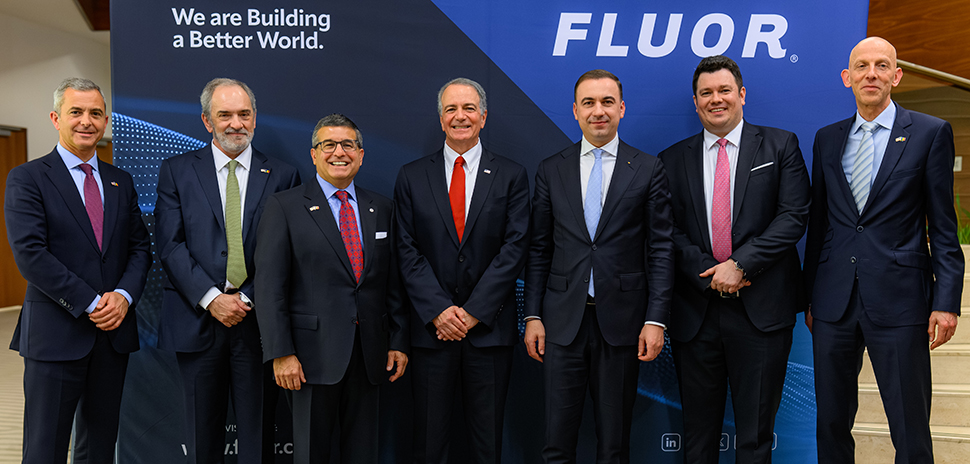
The Irving-based Fluor Corporation is opening a new European office in Bucharest, Romania. United States and Romanian government officials, industry leaders, and project partners recently joined Fluor executives and employees at the new office, located at the Avantgarde Office Building, to commemorate the event....

Velocity | Sim Racing Lounge aims to bring the thrill of motorsports to Dallas this summer with 34 “world-class racing simulators” in the state’s largest sim racing center.
Velocity’s 10,000-square-foot-plus venue will be located at The Hill shopping center at 9830 N....
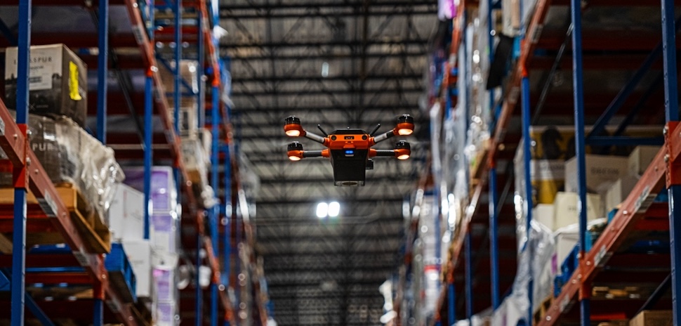
Dallas- and Miami-based Southern Glazer’s Wine & Spirits is partnering with Silicon Valley’s Corvus Robotics for a nationwide rollout of a drone-conducted inventory system.
The Corvus One autonomous inventory management system is now in use across Southern Glazer’s distribution network....

Trending
North Texas is a big place, with plenty to do, see, hear, and watch. We scour the internet every week to find events and activities for you. As always, things may change at any time, so be sure to check the official website or registration page for the latest details....
A few years ago, the digital leadership team of a globally recognized motorcycle brand reached out to us after completing a major digital refresh. They had followed every recommended best practice....
The Irving-based Fluor Corporation is opening a new European office in Bucharest, Romania. United States and Romanian government officials, industry leaders, and project partners recently joined Fluor executives and employees at the new office, located at the Avantgarde Office Building, to commemorate the event....
Velocity | Sim Racing Lounge aims to bring the thrill of motorsports to Dallas this summer with 34 “world-class racing simulators” in the state’s largest sim racing center.
Velocity’s 10,000-square-foot-plus venue will be located at The Hill shopping center at 9830 N....
Dallas- and Miami-based Southern Glazer’s Wine & Spirits is partnering with Silicon Valley’s Corvus Robotics for a nationwide rollout of a drone-conducted inventory system.
The Corvus One autonomous inventory management system is now in use across Southern Glazer’s distribution network....